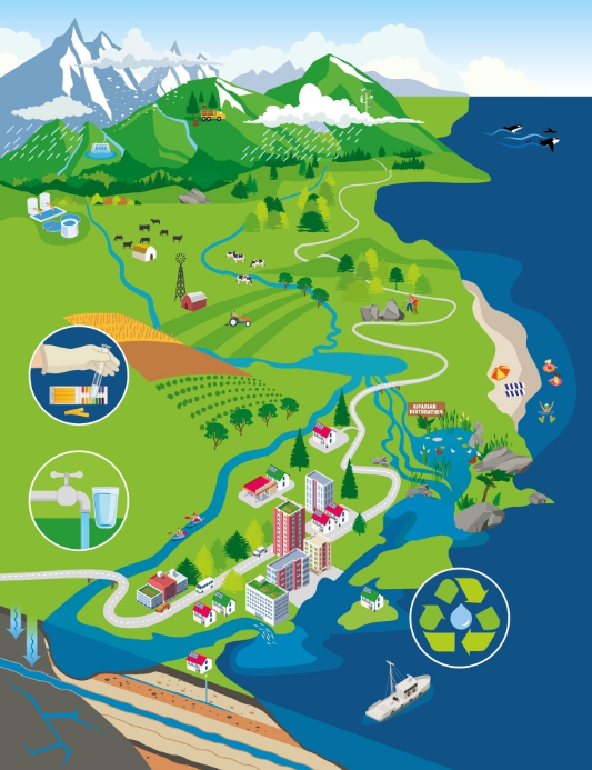
Water Budget Project
The Water Budget Project is focused on understanding how much water is available in the Regional District of Nanaimo. This involves a series of studies to examine the relationship between:
- Surface and groundwater
- Current water demands
- Long-term impacts of climate change
Climate change projections tell us to expect warmer winter weather. This will compromise upper elevation snowpack and bring more extreme rain events. Meanwhile, in the summer, we have less rain and higher temperatures, resulting in longer drought periods.
As the population grows and the climate changes, water conservation and protection of natural watershed assets will be a priority. There is a need to meet population growth with a sustainable water supply that maintains healthy ecosystems. Water budget studies will help us understand the water availability and constraints of the aquifers and surface waterbodies across the region.
Water Budget and Watershed Stress
A Water budget uses simple accounting to compare how much water goes into and out of a system. When more water is taken out than is replenished, the system may experience stress.
Much like a bank account, if more water is leaving than is coming in, the supply will be depleted. A level of reserve is included in the balance. The water use is sustainable when supply and demand are in balance. When demand outstrips supply, a watershed or aquifer can experience stress.
Project Phases
The Water Budget Project is a multi-year, multi-phased project:
- Phase One: Create a basic model of the watershed, calculate the water budget, and assess whether the area has low, moderate, or high stress.
- Phase Two: Gather and analyze data to set priorities. Low stress means continuing regular data collection, while moderate/high stress means collecting extra targeted data.
- Phase Three: Use models to understand the watershed and develop a management plan, including studies on ecology, climate, and water quality.
The project is currently in Phases Three. This includes ongoing monitoring and data collection based on recommendations found in Phase One and Two.
Phase One - Region-Wide Conceptual Model
Phase One project tasks included:
- Developing a better understanding of the hydrological cycle and the interactions between rivers, creeks, lakes, and groundwater aquifers.
- Estimating current water demands, the stresses placed on rivers, creeks and aquifers by human activities, as well as long-term effects of changing climate conditions.
- Identifying uncertainties and data gaps in the analysis.
The results obtained in Phase 1 provided preliminary insight into the sustainability of current water use practices in each water region, and have been used to identify areas of concern for further study.
- Water Region 1 - Big Qualicum
- Water Region 2 - Little Qualicum
- Water Region 3 - French Creek
- Water Region 4 - Englishman River
- Water Region 5 - South Wellington to Nanoose
- Water Region 6 - Nanaimo River (including Cassidy-Cedar-Yellowpoint)
- Water Region 7 - Gabriola, DeCourcy & Mudge Islands
Regional District of Nanaimo Agricultural Water Demand Model - 2013
Phase Two - Gap Analysis and Data Collection
Phase Two rolled out between 2014 -2016 in the three priority areas that were identified in the first phase: Nanoose, French Creek, and Cedar-Yellowpoint.
The focus of Phase Two was on expanded data collection and monitoring, to fill gaps identified in the initial datasets used for the analysis. It included the instrumentation of additional volunteer observation wells, a new hydrometric station, and low flow monitoring. This was a key step in preparation for Phase 3.
Phase Three - Refined Numerical Water Budgets for Priority Regions
Currently underway, Phase Three sees the development of a numerical model for surface and groundwater to run scenarios that illustrate and quantify potential impacts of climate change projections, land use and development changes, and increased extraction. This is a necessary tool for developing long term water supply strategies for priority areas.
In 2020, the first Phase Three numerical water budget model was completed for Nanoose (Electoral Area E). At this time, the RDN is looking to advance the development of a Phase Three water budget model for the French Creek Water Region. It has been identified in previous studies and by ongoing monitoring that the surface water flows and the groundwater levels in portions of this water region are under stress. This reveals the need for a future-looking analysis that provides the technical basis for a long-term strategy for water supply, from both the community and ecological perspective.
Priority Regions:
- Refined Water Budget (Phase 3) for Nanoose (Electoral Area E) - 2020
- French Creek Water Region Phase 3 Water Budget - 2023
- Cedar-Yellowpoint-Cassidy - in progress