Electoral Area B Community Parks
Electoral Area B Recreation & Parks Master Plan
The Recreation and Parks Master Plan for Gabriola Island and Electoral Area B (2025) sets a clear vision for recreation and parks over the next decade. Developed through extensive community engagement and research, the plan includes strategies to:
- Expand and diversify recreation programming and spaces
- Explore a multi-purpose community centre and improve sport fields
- Protect sensitive ecosystems
- Enhance shoreline access
- Connect and diversity the trail network
This plan will help ensure that priorities and resources are aligned to maximize community benefit and protect the unique environment of Gabriola, Mudge, and DeCourcy Islands.
Download the Plan: Electoral Area B Recreation & Parks Master Plan (PDF)
For background reports and engagement summaries, visit: getinvolved.rdn.ca/ea-b-rpmp
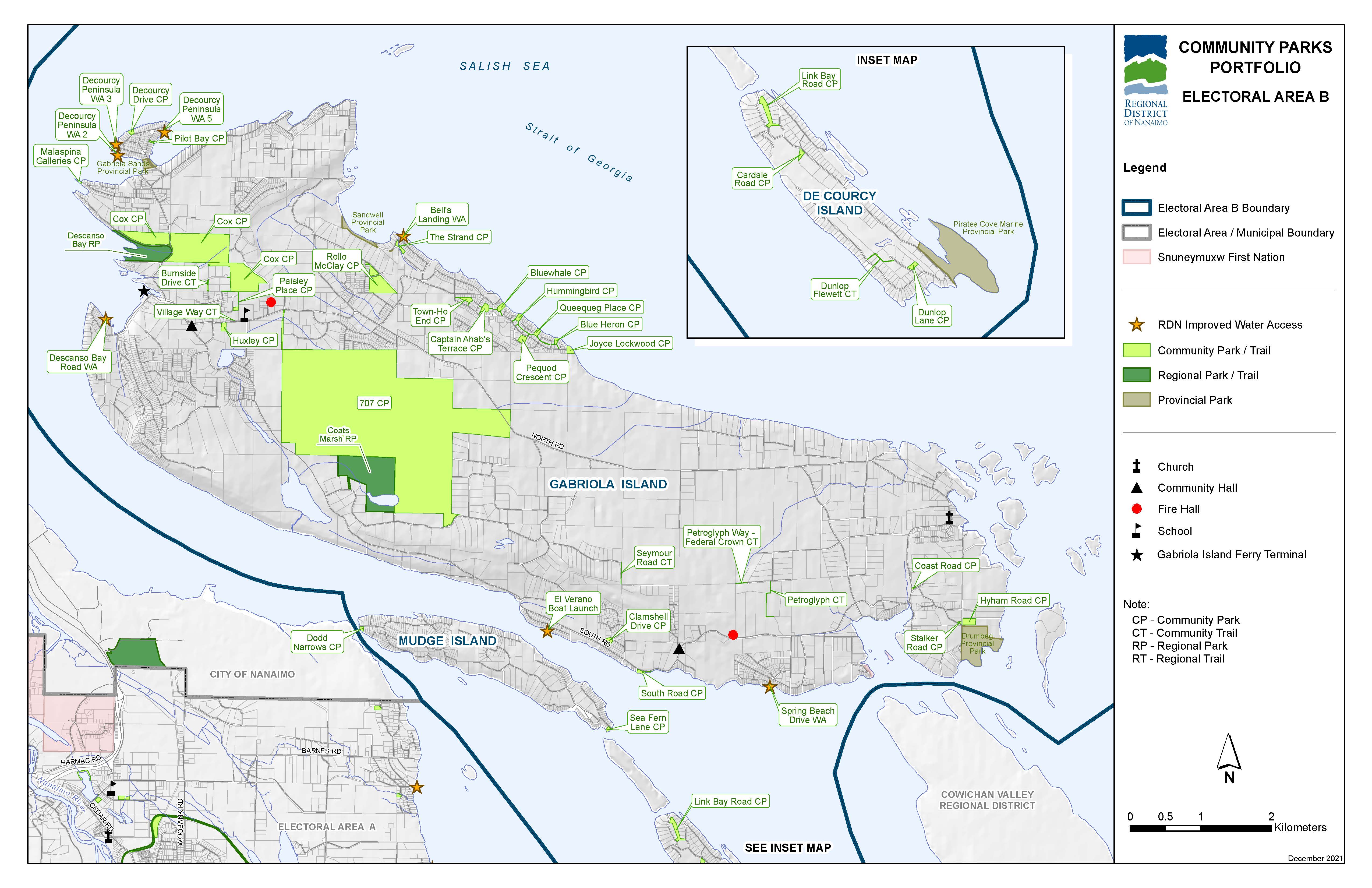
Click map to download large PDF version
Electoral Area B's Community Parks and Trails include:
- Cox Community Park
- Cardale Road Community Park
- Dunlop Lane Community Park
- Sea Fern Lane Community Park
- Link Bay Road Community Park
- Blue Heron Community Park
- Queequeg Place Community Park
- Hummingbird Community Park
- Bluewhale Community Park
- Captain Ahab's Terrace Community Park
- Town-Ho End Community Park
- Pequod Crescent Community Park
- Clamshell Drive Community Park
- Decourcy Drive Community Park
- Pilot Bay Community Park
- The Strand Community Park
- Rollo McClay Community Park
- Joyce Lockwood Community Park
- 707 Community Park
- South Road Community Park
- Coast Road Community Park
- Hyham Road Community Park
- Stalker Road Community Park
- Malaspina Galleries Community Park
- Paisley Place Community Park
- Huxley Community Park
- Dodd Narrows Community Park
- Burnside Drive Community Trail
- Village Way Community Trail
- Dunlop Flewett Community Trail
- Petroglyph Way – Federal Crown Community Trail
- Petroglyph Community Trail
- Seymour Road Community Trail