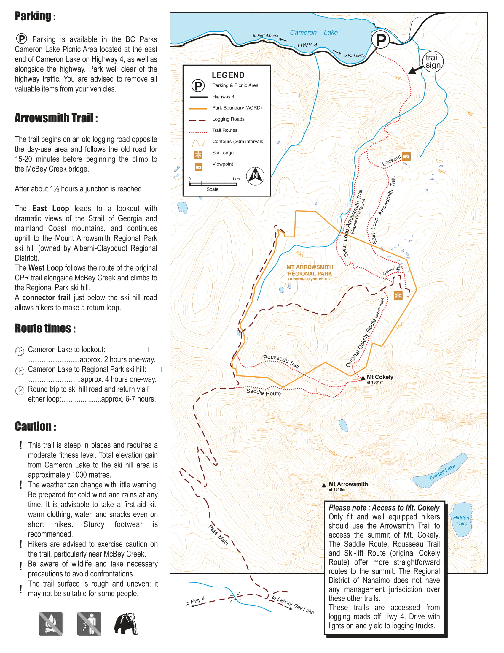
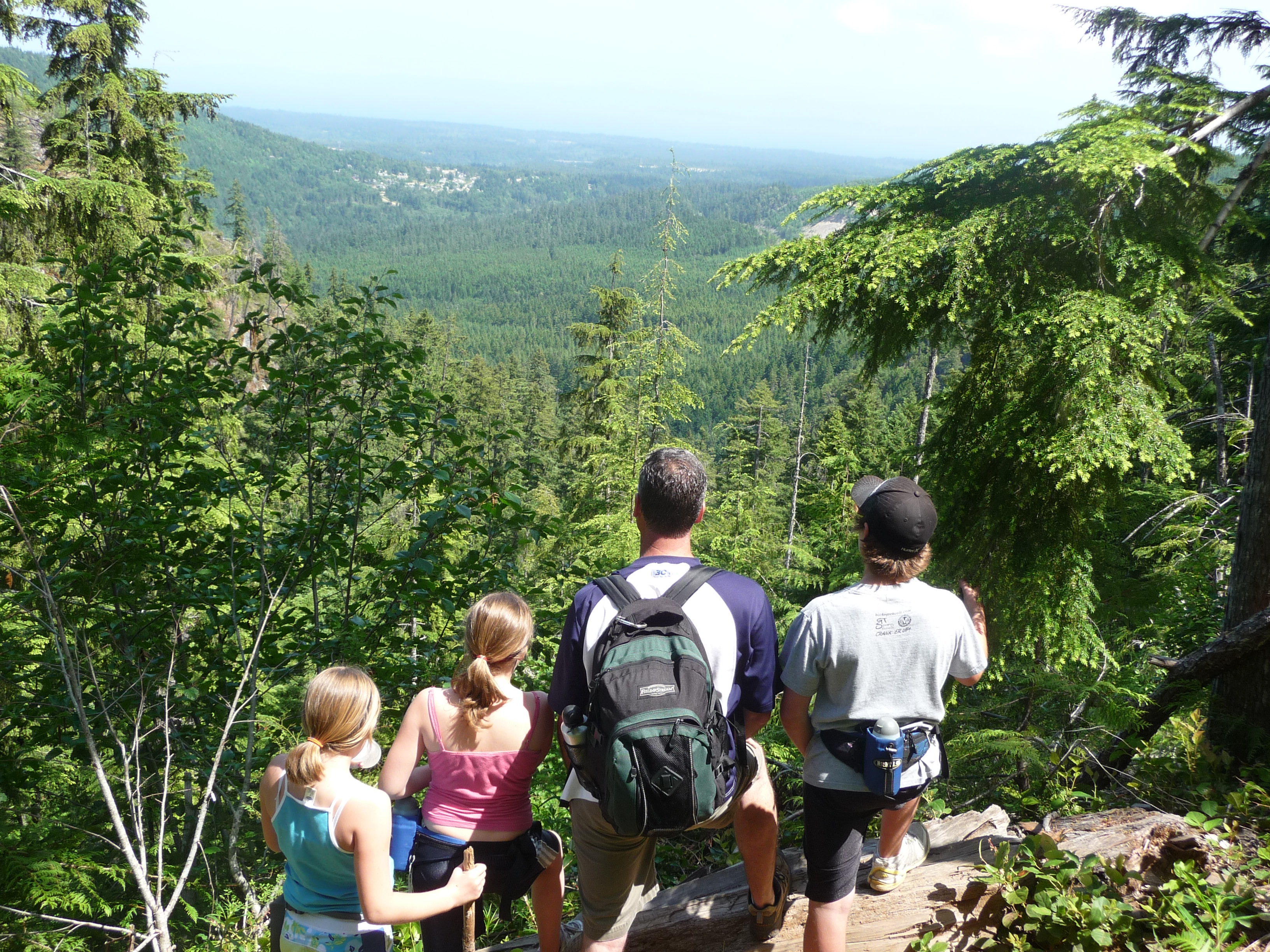
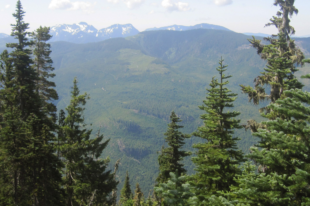
Arrowsmith CPR Regional Trail
Situated on private forest lands under licence to the RDN, the trail winds up from Highway 4A through deep woods, develops into a loop, and finishes at an old ski hill below Mt Cokely. It's a good four-hour climb with 1,000 metres in elevation gain on rough but ready trail. The views from the forested mountain trail are spectacular, and there is a great lookout halfway up. It's high country so be prepared: pack water, warm clothing and wear sturdy boots.
New wayfinding signage has been installed along the trail. The signage includes reflective trail marker, maps and emergency contact information to help locate hikers in the even of an emergency.
What to do
Hiking

Park Map